Statement from City of Boroondara’s Mayor, Cr Lisa Hollingsworth
Council is deeply concerned with the latest housing plans released by the state government for the proposed Camberwell Junction Activity Centre.
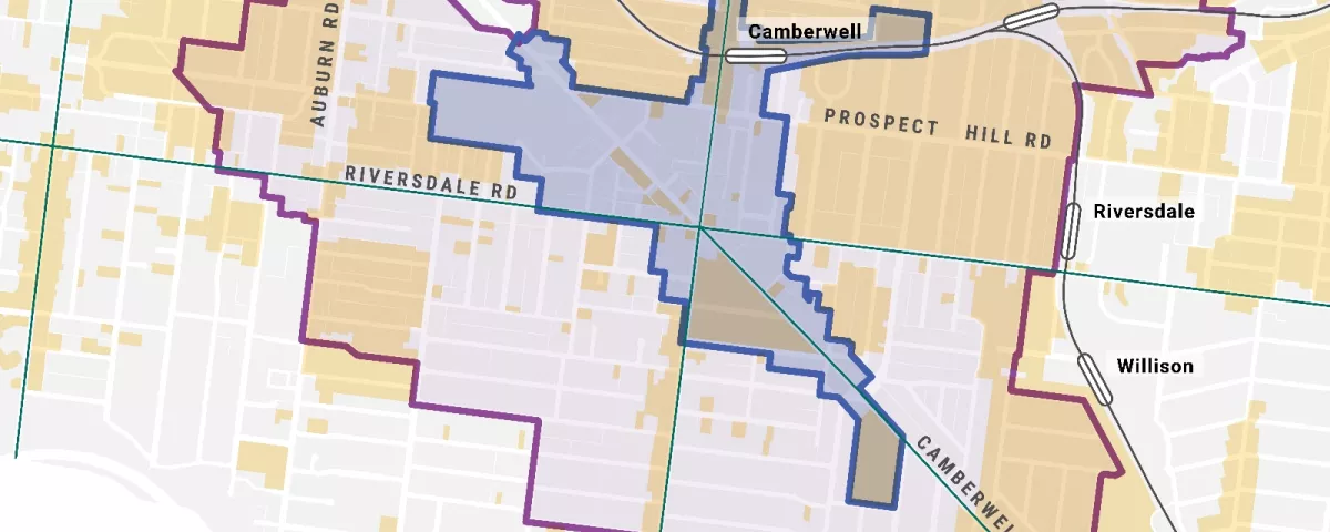
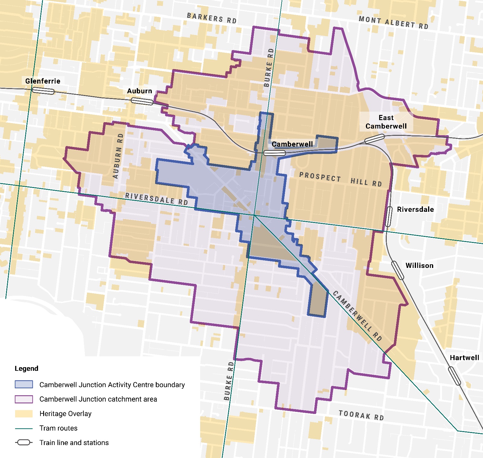
Their draft plans feature 2 areas proposed to accommodate taller buildings and larger developments - an Activity Centre zone and a new “catchment area” (an 800m expansion from the proposed activity centre boundary).
The Activity Centre zone proposed is the same as that reflected in Council’s adopted Camberwell Junction Structure and Place Plan, which was developed based on extensive research and consultation with the community. Council is supportive of this activity centre area.
What Council is not supportive of is the additional ‘catchment area’ that extends a further 800m from the boundary of the centre and will allow for development height up to 6 storeys in heritage areas and low scale single dwelling leafy neighbourhoods. Neither Council nor the community have been consulted on this alarming new catchment area, which is illogical and representative of poor planning.
This vast catchment area encompasses 4,500 heritage listed properties. It is estimated that approximately 48% of this catchment area is land currently protected by the Heritage Overlay (refer to map provided). Council does not support this catchment area in any way and condemns the state government’s disregard for local heritage and amenity. This catchment area has been imposed with no evidence of any strategic analysis, assessment of local infrastructure capacity or consideration of the impact on local services and community facilities.
Any claims by the Minister for Planning that they have undertaken consultation with Council on the latest version of their plans are completely false. Council only obtained a copy of the latest plans via the state government’s website on Thursday 22 August, after media releases and announcements were made by the Minister.
Council has only ever advocated for its adopted Camberwell Junction Structure and Place Plan to be authorised by the state government, to enable its translation into the Boroondara Planning Scheme.
Council has acted as a model planning authority and successfully worked with the community and stakeholders to plan for future housing, economic development, public realm investment and transport improvements while protecting the character and amenity of Camberwell that the community love.
Council calls on the state government to follow its lead in positively engaging with the community and stakeholders to shape our collective future, rather than impose rushed plans that override local character and amenity by destroying local heritage in the process.
More information
For more information about the changes to planning in Victoria introduced by the Victorian Government to deliver its Housing Statement and housing targets, visit our Victorian Government changes to planning page.